Skip to content
Reality Modeling Services
A digital twin of your project—clear, accurate, and actionable.
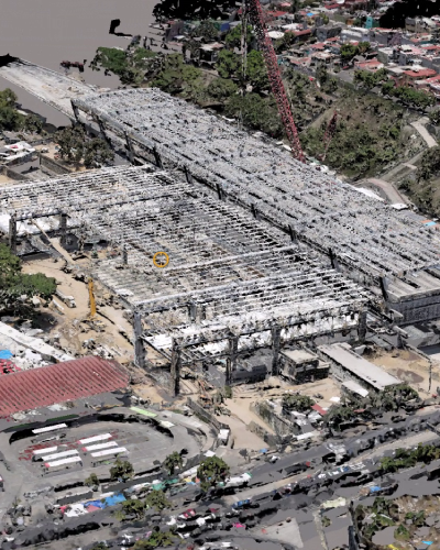
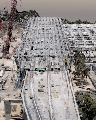
Imagine having an exact digital replica of your project, allowing you to visualize and understand every detail with precision. That’s what our Reality Modeling (RM) services offer: the creation of a high-fidelity geometric mesh that reflects the current state of your construction site.
Using drone photography, point clouds, and survey data, we transform raw information into a smart, visual model that’s easy to share, navigate, and analyze. This digital twin helps you make faster, more informed decisions while keeping your project moving forward.
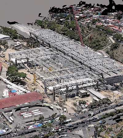
Our models are compatible with collaborative platforms like iTwin Experience and SYNCHRO Control, and can be viewed on free tools like iTwin Desktop Viewer. No matter where your team is, everyone can access the same up-to-date information—bringing alignment, clarity, and control.
But the real power of Reality Modeling is in its application:
- Measure construction progress over time
- Compare current conditions with previous stages
- Extract accurate material volumes
- Integrate with 4D BIM workflows for advanced planning
In short, Reality Modeling transforms how you manage your projects—making them more visible, measurable, and successful.
Service Options

Mesh Modeling:
Mesh Modeling:

Full-Service Modeling
Full-Service Modeling
This service can be offered in two ways:
Mesh Modeling:
We process existing site data—point clouds, drone images, video, or topographic surveys—and deliver a high-quality geometric mesh as a shareable asset.
Full-Service Modeling
We conduct the site capture ourselves using our equipment, process all data, and deliver a complete geometric model of your project.
Key Benefits
Optimized Format
Get an exact, shareable replica of existing site conditions in a practical and versatile format.
Progress Tracking

Monitor construction progress by comparing current conditions against previous stages—clearly visualizing what’s been completed.
High Accuracy
High-resolution imagery allows you to detect even the smallest details, helping you assess variations that may affect design or construction.